Overnight storm line prompts severe thunderstorm watch and warnings across metro Atlanta and north Georgia
Storms arrive after a dry Monday, then intensify into late evening
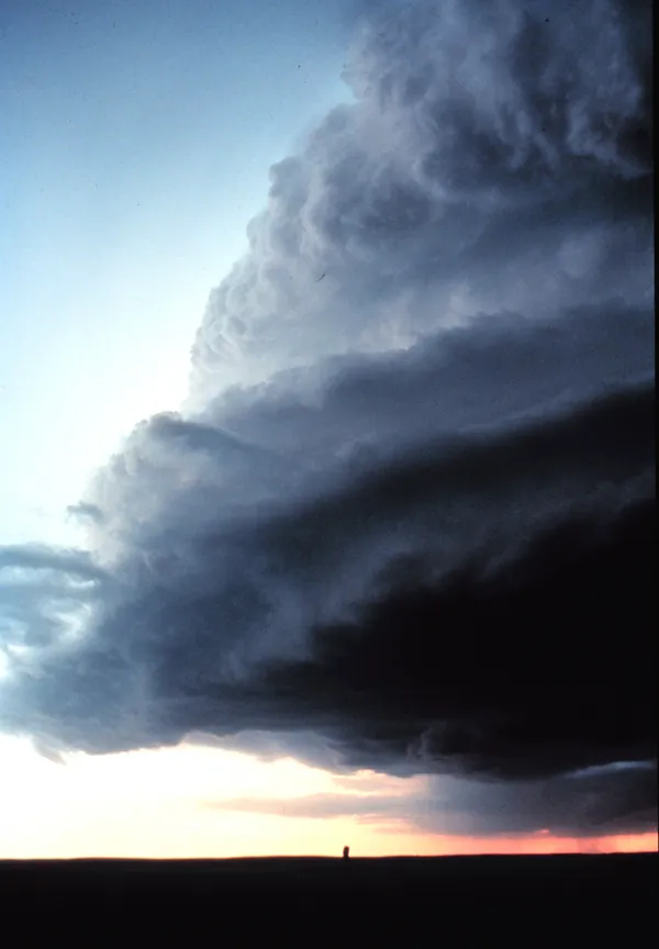
A line of strong thunderstorms moved into north Georgia Monday night and advanced toward metro Atlanta through the overnight hours, prompting a severe thunderstorm watch that included much of the region. The primary hazard was damaging straight-line wind, with hail also possible and a limited risk of a brief, fast-developing tornado in the strongest storms.
The watch covered a wide swath of north and west metro counties, including Bartow, Carroll, Chattooga, Cherokee, Clayton, Cobb, Coweta, DeKalb, Douglas, Fayette, Floyd, Fulton, Haralson, Meriwether, Paulding, Polk and Troup, and remained in effect late into the evening. As the storm line approached and crossed parts of the metro, warnings were issued and then allowed to expire as the most intense segments moved through.
Where warnings were issued and how the threat evolved
During the late evening, severe thunderstorm warnings were issued for multiple counties on the northwest and west side of the metro before expanding into central portions of the region. Warnings were time-limited and were subsequently discontinued as storms weakened or shifted eastward. In the late-night timeline, warnings included areas such as Bartow, Carroll, Cobb, Coweta, Douglas, Fulton and Paulding, as well as earlier warnings affecting Floyd, Haralson and Polk.
Forecast messaging emphasized that the storm environment supported isolated severe cells embedded within the broader line. The expected impacts were consistent with early spring convective setups common in Georgia, where strong wind fields can organize storms into a forward-moving line capable of producing damaging gusts.
What residents typically face during overnight severe storms
Overnight storms create added risk because many residents are asleep when warnings are issued. The most common local impacts from severe thunderstorm events include downed trees and limbs, power interruptions, and hazardous travel from sudden heavy rain and reduced visibility.
- Damaging wind gusts that can bring down trees and power lines
- Isolated hail, potentially up to quarter size in the strongest cores
- Brief spin-up tornado risk within the line, though not expected to be widespread
Active pattern continues into midweek
The overnight round did not signal an end to the unsettled weather. Forecasts called for additional scattered storms Tuesday, with another opportunity for stronger to severe storms developing Wednesday night into Thursday as a cold front approaches. With multiple rounds possible, residents across metro Atlanta and north Georgia are expected to see changing conditions over a short period, including the potential for renewed thunderstorms and locally strong wind.
For overnight severe weather, emergency managers typically advise keeping multiple ways to receive warnings, especially when sleeping.
As conditions evolve through the week, the timing and intensity of any additional severe storms will depend on how quickly the next system organizes and how much instability develops ahead of the front.