Foggy Mornings and Unseasonable Heat: Atlanta’s Monday Weather Breakdown
Morning Commute: Heavy Fog and Mild Starts
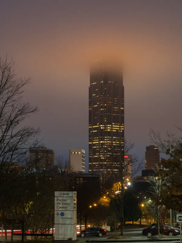
Atlanta residents waking up this Monday, March 9, 2026, should prepare for a slow start on the roads. The National Weather Service has issued warnings regarding the development of dense fog across North and Central Georgia. Early morning visibility is expected to drop as low as one-quarter mile in several areas, making the use of low-beam headlights and maintaining extra following distance essential for the morning rush. Despite the gray start, temperatures are starting out quite mild, hovering around 58 to 60 degrees Fahrenheit, which is significantly higher than the seasonal average for early March.
Afternoon: Peak Warmth and Cloud Cover
As the fog lifts by mid-morning, the city will move into a period of unseasonable warmth. Forecasters expect daytime highs to climb into the mid-to-upper 70s, with some models and regional climatological reports suggesting a peak between 76 and 80 degrees. This surge is roughly 15 to 20 degrees above typical March norms, fueled by persistent southwesterly flow along the western edge of surface high pressure. The sky will remain mostly cloudy throughout the day, though occasional sun breaks may occur. While the day will be largely dry, there is a 35% chance of light, stray showers during the afternoon hours as a moist airmass remains entrenched over the Southeast. High humidity levels, forecasted to stay around 69% during the day, will add a late-spring feel to this Monday.
Evening and Night: Approaching Storms
The weather is expected to take a more active turn as we head into the evening and overnight hours. The chance of precipitation increases to 40%, with scattered showers and isolated thunderstorms becoming more likely after sunset. A weak cold front approaching the region will serve as the catalyst for these developments. While widespread severe weather is not currently anticipated for tonight, meteorologists are monitoring the potential for isolated strong storms to approach the metro area late Monday night into early Tuesday. Overnight lows will remain steady near 64 degrees, keeping the air thick and warm.
Weekly Outlook and Safety Reminders
- Visibility Alerts: Use low-beam headlights during the morning fog; avoid using high beams as they reflect off the moisture and further obscure vision.
- Hydration: With temperatures nearing record-level warmth for this date, ensure you stay hydrated if you are working or exercising outdoors.
- Storm Monitoring: Keep a weather radio or alert app active this evening as rain and thunderstorm chances increase after dark.
- Extended Trend: This unseasonable warmth is expected to persist through midweek before a more significant cold front arrives on Thursday to bring temperatures back toward seasonal averages.