Atlanta Frozen: Winter Storm Fern Grips the City with Dangerous Ice
Overview of the Icy Sunday
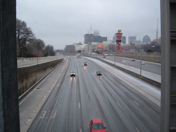
Atlanta is currently under the grip of a significant weather event as Winter Storm Fern moves through the region this Sunday, January 25, 2026. Governor Brian Kemp has issued a State of Emergency for all counties in Georgia, and an Ice Storm Warning remains in effect for the entire metro area. Residents are urged to avoid all non-essential travel as the storm brings a dangerous combination of freezing precipitation and biting winds.
Morning: The Onset of Freezing Rain
The morning hours are expected to be the most hazardous for commuters and emergency services. Forecasters predict freezing rain will be the primary concern before noon, with temperatures hover near the freezing mark. Ice accumulations between 0.25 and 1 inch are possible, particularly on elevated surfaces, trees, and power lines. Travel is considered nearly impossible during this window, as bridges and overpasses are likely to become slick and impassable shortly after daybreak.
Afternoon: A Cold, Slushy Transition
As we head into the afternoon, a slight rise in temperature may offer a transition from freezing rain to liquid rain showers. The predicted high for the day is approximately 39°F. However, meteorologists warn of a sharp temperature gradient across the state; while parts of central Georgia may see much warmer conditions, the 'wedge' of cold air over North Georgia is expected to hold firm. Even if the precipitation turns to rain, the accumulated ice will remain a significant threat to infrastructure. Winds will persist from the southeast at 10 to 15 mph, with gusts reaching up to 25 mph, increasing the likelihood of falling tree limbs.
Evening and Overnight: The Deep Freeze
The weather will take another turn for the worse after sunset. Rain showers are expected to taper off by 7:00 PM, but as the sky remains mostly cloudy, temperatures will plummet to an overnight low of 23°F. Northwest winds will pick up speed, gusting as high as 35 mph. This rapid drop in temperature will lead to the formation of 'black ice,' making any wet roads extremely treacherous. Residents should be prepared for prolonged power outages throughout the night as the weight of the ice combined with high wind gusts impacts the electrical grid.
Emergency Alerts and Critical Disruptions
In addition to the Ice Storm Warning, several critical service notices are in effect:
- MARTA: The transit authority is operating on a significantly reduced schedule. Only 'lifeline' bus routes are active to provide access to medical facilities. Rail service is running every 20 minutes to keep tracks from icing over.
- Air Travel: Hartsfield-Jackson Atlanta International Airport (ATL) is experiencing major disruptions. More than 60% of flights are expected to be cancelled today.
- Safety Warning: GEMA/HS encourages residents to stay indoors. If you must travel, keep an extra flashlight, food, and water in your vehicle in case of an emergency.