Atlanta Braces for Impact: Winter Storm Watch and Plunging Temps on the Horizon
Morning: A Crisp and Quiet Start
Atlanta wakes up to a deceptively calm and crisp morning this Friday, January 30, 2026. Early risers will step out into temperatures hovering near the freezing mark, with a starting low of 28°F. The sky remains partly cloudy throughout the early hours, offering a bit of sunshine as residents begin their commutes. Winds are expected to remain calm, providing a brief window of stability before the weather shifts later in the day.
Afternoon: Clouds Build as Temperatures Peak
By midday, the high is expected to reach approximately 48°F. While these temperatures are typical for late January, the atmosphere will turn increasingly unsettled. After 1:00 p.m., the chance of scattered showers increases to 20%. The Georgia Department of Transportation (GDOT) has already begun brine operations across the region as of 7:00 a.m. this morning to prepare for the incoming wintry conditions. In the metro Atlanta area specifically, these treatment operations are scheduled to intensify late tonight.
Evening and Overnight: The Transition to Winter
The real story begins after sunset as a cold front sweeps through the city. Temperatures will begin a sharp descent toward an overnight low of 22°F. According to the National Weather Service, the weather timeline for this evening includes:
- 7:00 p.m. – 10:00 p.m.: A slight chance of rain as clouds thicken and temperatures drop.
- 10:00 p.m. – 1:00 a.m.: A transition period where rain is expected to mix with sleet and snow.
- After 1:00 a.m.: Precipitation shifts primarily to snow showers, with the potential for accumulation starting in the early hours of Saturday morning.
Crucial Alerts and Safety Warnings
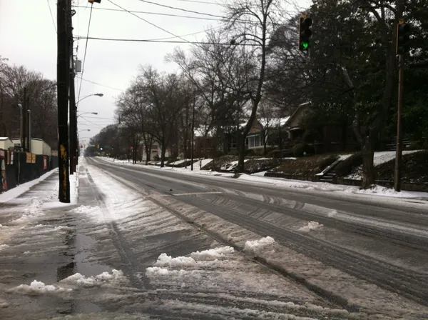
The National Weather Service has issued a Winter Storm Watch for metro Atlanta and much of North Central Georgia, effective from this evening through Sunday morning. Forecasters are predicting total snow accumulations of up to two inches, with higher amounts possible in localized areas. Additionally, an Extreme Cold Watch is in effect, as wind chills are expected to plummet between 5 degrees below zero and the single digits by Saturday.
Residents are urged to take the following precautions:
- Ensure all outdoor pipes are insulated to prevent bursts during the 48-to-60-hour freeze.
- Avoid unnecessary travel starting late tonight, as even light snowfall on frozen ground will lead to hazardous, slick roadways.
- Dress in multiple layers, including hats and gloves, if you must go outdoors.
Stay tuned to local updates as this winter system develops, and prepare for significant travel impacts across the I-20 and I-75 corridors through the weekend.